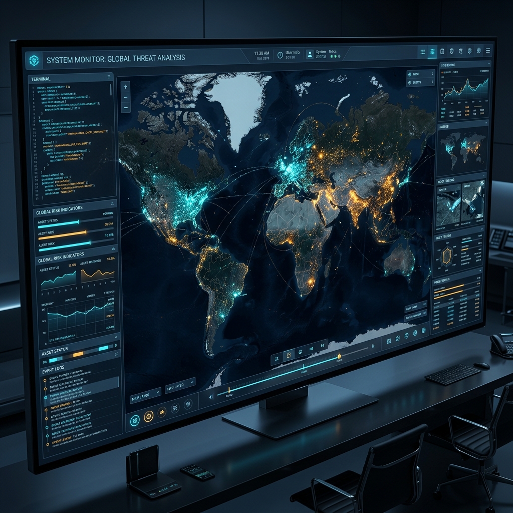
GEOPULSE is a free, open-source global intelligence dashboard that fuses satellite imagery, geopolitical data, live threat feeds, and interactive guided tours into one seamless command interface.
Six intelligence categories. Dozens of curated data sources. One unified terminal interface.
Real-time conflict zones, active war fronts, territorial disputes — updated continuously with click-through briefings on every flashpoint.
ISS real-time tracker. AIS shipping with global vessel positions. Starlink constellation visualizations. Launch Library 2 for upcoming missions.
Democracy vs. Autocracy (Freedom House). NATO, BRICS, SCO bloc memberships. Political regimes color-coded for instant recognition.
Global submarine cable networks. Hyperscale data centers by tier. Nuclear power plants with operational status and reactor counts.
NASA FIRMS wildfire data. Active volcano alerts (Smithsonian GVP). Global seismic activity. Radiation hotspots worldwide.
18 real webcam feeds worldwide. Alpine snapshot cameras (foto-webcam.eu) auto-refresh every 60s. YouTube embeds for global cities including Matterhorn, Kyiv, and Yosemite.
Switch the entire interface between English and German with one click. All layer descriptions, navigation, and educational tooltips translate instantly.
Interactive guided tours fly you around the globe with narrated educational briefings. Four categories: Geopolitics (Cold War, Chokepoints, Water Wars), History (WW1, WW2 with Wikipedia images), Science & Nature (Ring of Fire, Nuclear Legacy), and Sports (F1, FIFA World Cup) — with optional audio narration at each stop.

Weather radar · AIS shipping · EU aviation · ISS · Wildfires · Earthquakes · Internet outages · Solar activity
Regime classification · Geopolitical blocs · Active conflict zones · Country borders & labels · Undersea cables · Nuclear infrastructure
Submarine fiber cables · Hyperscale data centers · Nuclear power plants · Nuclear arsenals (SIPRI 2024)
Fully 9:16 optimized · ISS Tracker · 100+ live vessels · Submarine networks
18 webcams across the globe — from Alpine summits to world capitals. Two tiers of sources for maximum reliability: snapshot cameras that always work, plus YouTube embeds for global reach.
Cinematic guided tours fly you around the globe with educational briefings at every stop. Key locations display Wikipedia thumbnail images for visual context. Toggle the 🔊 AUDIO button for browser-native narration — no plugins required.
One-click preset: Nuclear sites, cables, and power infrastructure.
One-click preset: Maritime chokepoints, cables, and DEFCON alerts.
GEOPULSE is designed for instant intelligence — zero configuration required.
Navigate to the GEOPULSE URL. The command center loads instantly with live satellite imagery and all feeds active.
Toggle any combination of data layers from the sidebar — from seismic activity to undersea cables and nuclear sites.
Click any marker for detailed briefings. Take a guided tour with audio narration, or use scenario presets to explore specific global events.
GEOPULSE is a passion project built with MapLibre GL, vanilla JavaScript, and a deep fascination with global events. No paywalls. No accounts. No tracking. Just real-time intelligence for anyone who wants to understand the world.
Open the GEOPULSE map and watch the world in real time. Completely free. No registration required.
Launch Command CenterAvailable on all devices · No installation · No account required